
Файл:Virgin Forest in United States, 1926.png
Размер этого предпросмотра: 800 × 497 пкс. Другие разрешения: 320 × 199 пкс | 640 × 398 пкс | 1024 × 637 пкс | 1280 × 796 пкс | 2560 × 1591 пкс | 4200 × 2611 пкс.
Исходный файл (4200 × 2611 пкс, размер файла: 3,57 Мб, MIME-тип: image/png)
Краткое описание
| Описание |
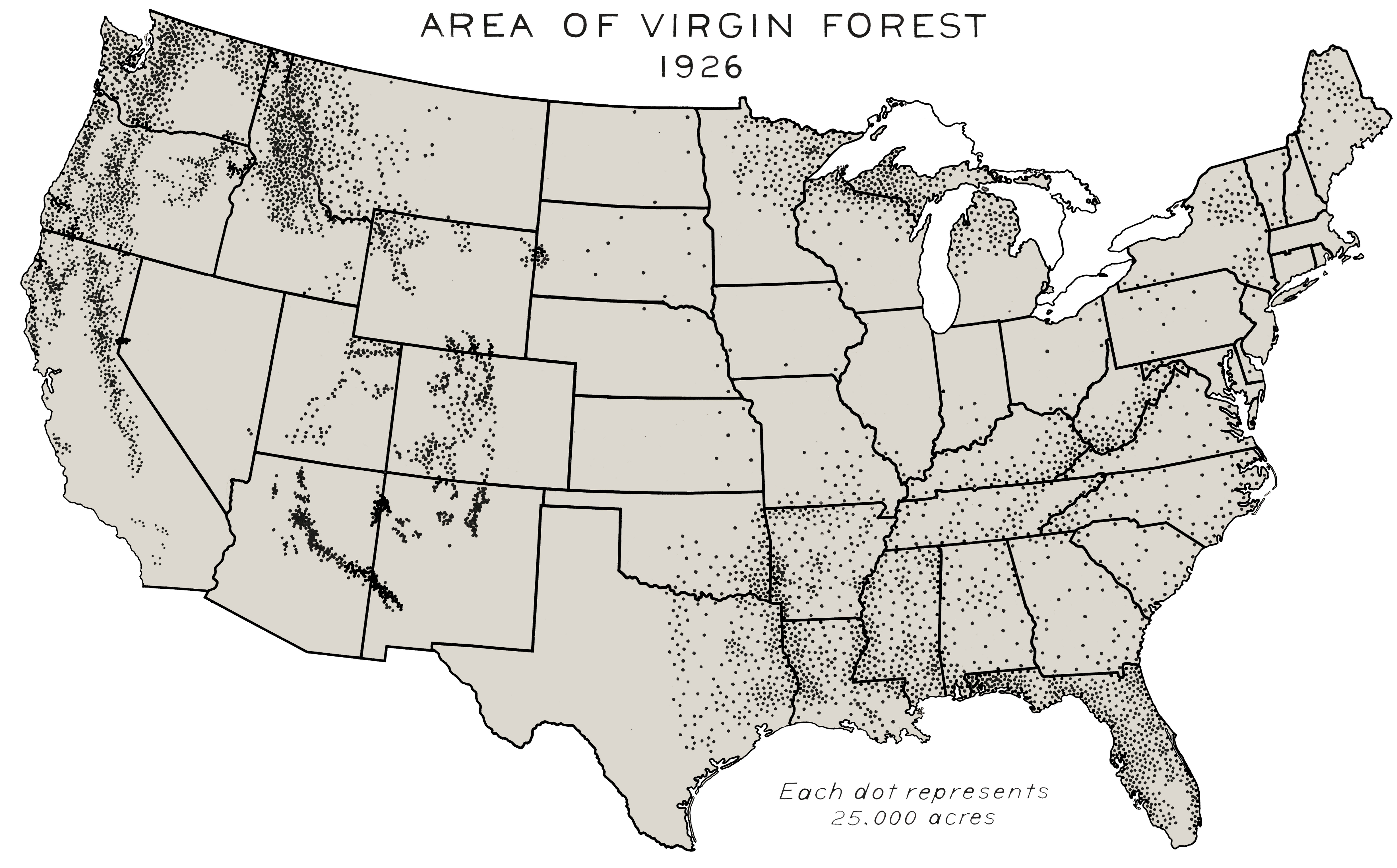
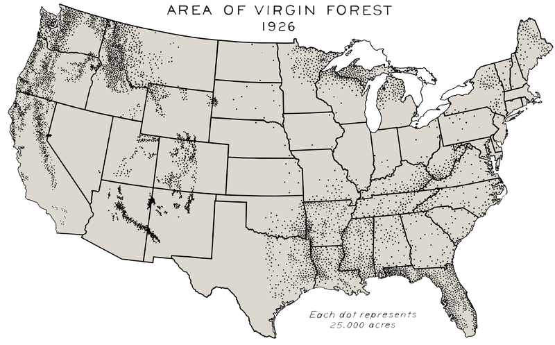
English: Forests never harvested by European settlers or their descendants, 1926. This map of the area of virgin forest in 1926 was compiled by William B. Greeley, who was chief of the U.S. Forest Service from 1920 to 1928, in his 1925 book The Relation of Geography to Timber Supply. This high-resolution version was created by the World Resources Institute from the original map in the U.S. National Archives.[1] This map can be seen as part of a four-image set constituted of File:Virgin Forest in United States, 1620.png, File:Virgin Forest in United States, 1850.png and a last one with protected copy rights[2] |
| Дата | |
| Источник | Southern Forests Flickr |
| Автор | William B. Greeley, US Forest Service |
Лицензирование
This image is a work of the Forest Service of the United States Department of Agriculture. As a work of the U.S. federal government, the image is in the public domain.
|
- ↑ see caption of the original image on Flickr.
- ↑ George Draffan (1992). Virgin Forests Today. Flickr. Southern Forests.
История файла
Нажмите на дату/время, чтобы увидеть версию файла от того времени.
| Дата/время | Миниатюра | Размеры | Участник | Примечание | |
|---|---|---|---|---|---|
| текущий | 22:55, 29 апреля 2012 | | 4200 × 2611 (3,57 Мб) | wikimediacommons>Hotshot977 |
Использование файла
Следующая страница использует этот файл: